Papers by Elizabeth Niespolo

PloS one, 2018
The archaeology of East Africa during the last ~65,000 years plays a central role in debates abou... more The archaeology of East Africa during the last ~65,000 years plays a central role in debates about the origins and dispersal of modern humans, Homo sapiens. Despite the historical importance of the region to these discussions, reliable chronologies for the nature, tempo, and timing of human behavioral changes seen among Middle Stone Age (MSA) and Later Stone Age (LSA) archaeological assemblages are sparse. The Kisese II rockshelter in the Kondoa region of Tanzania, originally excavated in 1956, preserves a ≥ 6-m-thick archaeological succession that spans the MSA/LSA transition, with lithic artifacts such as Levallois and bladelet cores and backed microliths, the recurrent use of red ochre, and >5,000 ostrich eggshell beads and bead fragments. Twenty-nine radiocarbon dates on ostrich eggshell carbonate make Kisese II one of the most robust chronological sequences for understanding archaeological change over the last ~47,000 years in East Africa. In particular, ostrich eggshell bea...

The Middle to Later Stone Age (MSA-LSA) transition in East Africa ~60-30 ka has been considered a... more The Middle to Later Stone Age (MSA-LSA) transition in East Africa ~60-30 ka has been considered a response to increased resource risk due to cooler, drier Late Pleistocene environments with greater short-term variability. Precisely dated local paleoenvironmental records can test such hypotheses. Ostrich eggshell (OES) fragments are common in African archaeological sequences, are amenable to 14C and U-series dating, and their δ13C and δ15N values can be used to infer C isotopes of consumed vegetation and mean annual precipitation (MAP), respectively. Here we show that OES preserve primary stable isotope compositions for up to ~50 ka at rock shelters GvJm-22 Lukenya Hill (Kenya) and Kisese II (Tanzania). At both sites, mean δ13C and δ15N values indicate elevated MAP during the African Humid Period (AHP, ~14-3 ka) relative to previous intervals, increasing confidence in our paleo-MAP values. Temporal variation in δ13C values is modest and masked by short-term variability, but mean δ13C values tend toward more C4-rich flora during intervals with lower precipitation. OES δ 15 N values at Lukenya Hill show overall increasing MAP from an arid MIS 3 (57-29 ka) to the AHP. In contrast, over the past 50 ka precipitation oscillated at Kisese II, with MIS 3 reflecting MAP as wet as the AHP and a drier MIS 2 (29-14 ka). Accordingly, we infer that distinctly different climatic trends prevailed during the MSA-LSA transitions at Lukenya Hill (~>46-26 ka) and Kisese II (~36-34 ka). Our results suggest contrasting paleoenvironmental trends through time at sites separated by only ~300 m elevation, 3° latitude, and 350 Km. Such site-specific records suggest a mosaic of local environments that is not apparent from global or regional paleoenvironmental records. This approach may allow closer examination of the relation between paleoenvironments and diverse patterns of behavioral change across the East African MSA-LSA transition.

We present the first integrated tephrochronological study (major and trace elemental glass compos... more We present the first integrated tephrochronological study (major and trace elemental glass composition, Sr and Nd isotope analyses, and 40 Ar/ 39 Ar dating) for the last one tenth (~82 m) of the ~900 m-thick Quaternary lacustrine succession of the Fucino Basin, the largest and probably only Central Apennine intermountain tectonic depression that hosts a continuous lacustrine succession documenting the Plio-Quaternary sedimentary history up to historical times. Major element glass compositions, determined using a wavelength-dispersive electron microprobe (WDS-EMPA), yielded the geochemical fingerprinting needed for a reliable identification of most of the 23 stratigraphically ordered tephra layers under investigation. These include tephra from Italian volcanoes such as Campi Flegrei, Etna, Colli Albani, Ischia, Vico, Sabatini, and undefined volcanic sources in the Neapolitan area and Latium region. The recognition of key Mediterranean marker tephra layers (e.g. X-5 and X-6) is supported by trace element data acquired by Laser Ablation Inductively Couple Plasma Mass Spectrometry (LA-ICP-MS). The Sr and Nd isotope compositions of selected layers where also determined for circumscribing the volcanic source of distal tephra and for supporting correlations with individual eruptive units. We also propose a new, more expeditious covariation diagram (CaO/FeO tot vs Cl) for identifying the volcanic source of trachytic to phonolitic and tephrytic to phonolitic tephra, that are the most common compositions of pyroclastic rocks from volcanoes of Campania and Latium regions. Finally, we present five new 40Ar/39Ar age de-terminations, including a new, analytically well-supported, and more precise 40Ar/39Ar age for the widespread Y-7 tephra, and the first 40Ar/39Ar age determinations for one tephra from the Sabatini volcanic district (~126 ka) and one tephra from Neapolitan volcanic area (Campi Flegrei?; ~159 ka). These newly dated tephra are widely dispersed (e.g. Monticchio, southern Italy, Adriatic Sea and Lake Ohrid, Macedonia-Abania) and have thus the potential to become important Mediterranean MIS 5 and MIS 6 tephrochronological markers. Altogether the new geochemical data and 40Ar/39Ar ages precisely constrain the chronology of the investigated Fucino succession spanning the last ∼190 ka. In light of these results and by considering that this sedimentary succession possibly extends back to ∼2 Ma, Fucino is likely to provide a very long, continuous tephrostratigraphic record for the Mediterranean area and become a key node in the dense network of tephra correlations of this region.

The accuracy of 40 Ar/ 39 Ar geochronology relies in large part on precise and accurate calibrati... more The accuracy of 40 Ar/ 39 Ar geochronology relies in large part on precise and accurate calibration of the ages and K-Ar isotopic compositions of standards. A widely used standard for Quaternary samples, the ~1.2 Ma Alder Creek sanidine (ACs), has published ages spanning a range of ~2%. New measurements of ACs co-irradiated with the Fish Canyon sanidine (FCs) standard and sanidines from astronomically dated Miocene tuffs in Crete and Morocco yield results that enable both (i) a direct calibration of ACs relative to FCs, and (ii) stepwise calibrations between these two standards employing the Miocene intermediaries. Results are summarized by the parameter R (ACs/FCs) , defined as the ratio of (40 Ar*/ 39 Ar K) of ACs to FCs, which embodies the fundamental age relationship between these standards that is independent of systematic variables such as decay constants or absolute ages of standards. Our new measurements, executed using three mass spectrometers and various irradiation and analytical protocols, yield a weighted mean R (ACs/FCs) = 0.041702 ± 0.000014 (s). This result can be combined with previously published determinations of R values for ACs relative to the Miocene tuffs and to FCs to yield a recommended interlaboratory value of R (ACs/FCs) = 0.041707 ± 0.000011. The weighted-mean age of ACs using this interlaboratory value, based on astronomically-calibrated ages of FCs and the Miocene intermediary sanidines, is t (ACs) = 1.1848 ± 0.0006 Ma (±0.05%). Applying this result to the most precise published 40 Ar/ 39 Ar data for the Matuyama-Brunhes geomagnetic polarity reversal yields t (MBB) = 780.1 ± 0.8 ka. In addition, these new data for ACs support previous conclusions that U-Pb zircon ages from the Alder Creek rhyolite incorporate ~13 ka of pre-eruptive residence time.

An 82 m long sedimentary succession was retrieved from the Fucino Basin, the largest intermountai... more An 82 m long sedimentary succession was retrieved from the Fucino Basin, the largest intermountain tectonic depression of the central Apennines. The basin hosts a succession of fine-grained lacustrine sediments (ca. 900 m-thick) possibly continuously spanning the last 2 Ma. A preliminary tephrostratigraphy study allows us to ascribe the drilled 82 m long record to the last 180 ka. Multi-proxy geochemical analyses (XRF scanning, total organic/inorganic carbon, nitrogen and sulfur, oxygen isotopes) reveal noticeable variations, which are interpreted as paleohydrological and paleoenvironmental expressions related to classical glacial–interglacial cycles from the marine isotope stage (MIS) 6 to present day. In light of the preliminary results, the Fucino sedimentary succession is likely to provide a long, continuous, sensitive, and independently dated paleoclimatic archive of the central Mediterranean area.
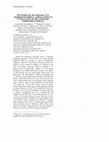
: Map of the Mt. Trumbull and surrounding areas. The purple region highlights the most frequent d... more : Map of the Mt. Trumbull and surrounding areas. The purple region highlights the most frequent discovery of MoapaGray Ware, with the Lowland Virgin area (green) and the St. George Basin area (Pink) being respectively secondary and tertiary areas of high frequency.

Stable isotopes and elemental geochemistry reveal a complex fluid history for jadeitites exposed ... more Stable isotopes and elemental geochemistry reveal a complex fluid history for jadeitites exposed both north and south of the Motagua Fault Zone (MFZ) in Guatemala. A companion study (Niespolo et al., 2014) utilized these data to source Mesoamerican jadeitite artifacts, as this region is the only source for such materials. Materials studied include jadeitites that range from 71% to 95% jadeite with minor albite and white mica. Jadeitites north of the MFZ have δ 18 O Jadeite = +9.2±0.6‰ (n=6), δ 18 O Albite = +9.4±0.3 (n=2), δ 18 O WhiteMica = +9.8±0.3 (n=3), and δD WhiteMica = -52± 4‰ (n=3). Jadeite δ 18 O values are 2-5‰ higher than those reported by Johnson and Harlow (1999), suggesting a diverse fluid history north of the MFZ. Water in apparent equilibrium at 400°C with north-MFZ jadeitite has δ 18 O = +8.5‰ and δD = -25‰. Jadeites from Carrizal Grande south of the MFZ have δ 18 O Jadeite = +6.8±0.6‰ (n=7), δ 18 O WhiteMica = +9.0±1.2 (n=6), and δD WhiteMica = -42±2‰ (n=5), with δ 18 O H2O = +6.4‰ and δD H2O = -15‰. In contrast, jadeitites from La Cieba south of the MFZ have δ 18 O Jadeite = +7.5±1.4‰ (n=5), δ 18 O Albite = +9.0, δ 18 O WhiteMica = +9.7±0.1 (n=2), and δD WhiteMica = -42±0‰ (n=2), with δ 18 O H2O = +7.2‰ and δD H2O = -14‰. Calculated fluids are consistent with those associated with the alteration of serpentinite in a subduction zone setting (e.g., Harlow and Sorenson, 2005). White mica, albite and jadeite are out of 18 O/ 16 O equilibrium. This suggests post-jadeite isotopic exchange, possibly during exhumation. North MFZ jadeites are enriched in Rb, Ba, Sc, Pb and Nd, and depleted in Sr, Ti, V, and Cr relative to chondrites. Carrizal Grande jadeites are depleted in Sr, Zr, V, and Cr, and enriched in REE and Rb.

The only known jadeitite source region utilized by Mesoamerican peoples lies in the Motagua Fault... more The only known jadeitite source region utilized by Mesoamerican peoples lies in the Motagua Fault Zone (MFZ) in Guatemala. Petrologic diversity of jadeitites within sub-regions north and south of the MFZ makes artifact provenance identification difficult using current methods. Major-and trace-element characterization using LA-TOF-ICP-MS and stable isotopes, paired with traditional petrologic studies, discriminate jade sources near the MFZ, refining a previous sourcing method utilizing only mineralogy. Oxygen isotope data deviates between jadeites found north and south of the MFZ by approximately 0.5 to 4.0‰, overlapping between +8.6 and +9.1‰. δ 18 O values of jade artifact samples from a Classic Maya jade workshop at Cancuén span the range of both groups. Stable isotope data paired with elemental enrichment and depletion trends relative to chondrites correlate source samples from the same sub-regions. Thus, stable isotopic overlap between North-and South-MFZ jadeites may be distinguished by jadeite elemental composition.
Mt. Trumbull is located on the Uinkaret Plateau in Northern Arizona and is among the most heavily... more Mt. Trumbull is located on the Uinkaret Plateau in Northern Arizona and is among the most heavily occupied archaeological sites in the plateaus area. Pottery technology was developed during the Formative Period in this area by those known as the Anasazi or Ancestral Pueblo people. Moapa Gray Ware, a unique olivine--tempered pottery type seen widely in the Anasazi region, derives from Mt. Trumbull and is frequently found in surrounding areas. Like other ware types, it is considered a cookware; however, with other pottery type sources more proximate to many of the areas where it is found, this project explores why Moapa Ware could be considered functionally advantageous over other pottery types that would have been more easily obtained by people not directly local to Mt. Trumbull.
Conference Presentations by Elizabeth Niespolo
Dating late Quaternary terrestrial strata is especially challenging beyond the ~50 ka limit of 14... more Dating late Quaternary terrestrial strata is especially challenging beyond the ~50 ka limit of 14C. Ostrich eggshell fragments (OES) are common in African archaeological sequences, consist of ~2 mm-thick low-Mg calcite with 1-3% organics, and are resistant to diagenesis in semi-arid to arid soils over geologic timescales. OES are amenable to 14C dating and are geochemically suitable for U-Th dating, though previous attempts neglected to account for secondary U derived from soil water upon burial. Recent work has shown that U-Th “burial dates” on OES are concordant with 14C dates for ~10-50 ka OES from an African rockshelter. We present LA-ICP-MS profiles of U and 232Th for ancient OES from 8 archaeological sites in sub-Saharan Africa spanning ~10 to >500 ka. They reveal undesirable elevated detrital 232Th and erratic 238U near OES surfaces and in secondary calcite filling macroscopic pores, guiding optimal sampling for dating. Patterns of U and 232Th are similar in OES from all localities and do not vary systematically with age, suggesting U uptake is self-limiting and [U] is controlled by soil composition. All OES have steep smooth gradients of [238U] (~100s to 10s of ppb) starting at or near their outer surface, continuing through the “palisade layer”, then dropping to near zero (primary) values, consistent with diffusive U uptake. SEM imaging and erfc-1(U/U0) v. distance plots indicate OES calcite structures control U diffusivity. OES >500 ka retain coherent U profiles, suggesting that U-Th burial dating of OES may be useful to the limit of secular equilibrium.


Uploads
Papers by Elizabeth Niespolo
Conference Presentations by Elizabeth Niespolo