
|
Level crossing at Liss, near Petersfield
by Malc McDonald
geograph for square SU7727
Traffic waits as a train leaves Liss station on the Portsmouth Direct Line and... (more)
|
|
Bridge over a railway near Liss
by Malc McDonald
geograph for square SU8029
A bridge carrying a minor lane across a railway line in the South Downs National... (more)
|
|
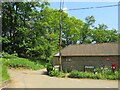
Langley Farm Road, near Liss
by Malc McDonald
geograph for square SU8028
Langley Farm Road passing a farm building in the South Downs National Park.... (more)
|
|
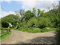
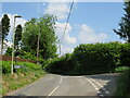
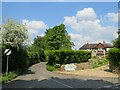
Road junction near Liss
by Malc McDonald
geograph for square SU7928
A junction of minor country lanes in the South Downs National Park. A... (more)
|
|
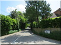
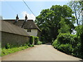
Hatch Lane, Liss, near Petersfield
by Malc McDonald
geograph for square SU7827
Hatch Lane is a minor road leading out of the village of Liss, in the South... (more)
|
|
Minor road junction, Liss, near Petersfield
by Malc McDonald
geograph for square SU7827
A junction of minor roads on the edge of the village of Liss, in the South Downs... (more)
|
|
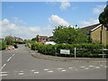
Greenfields, Liss, near Petersfield
by Malc McDonald
geograph for square SU7827
Greenfields leads into a housing development in Liss, in the South Downs National Park.
|

|
Station Road, Liss, near Petersfield
by Malc McDonald
geograph for square SU7727
Station Road in the village of Liss, in Hampshire. Liss lies within the South... (more)
|
|
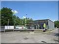
Liss Railway Station
by Malc McDonald
geograph for square SU7727
The modern station building at Liss in Hampshire. Liss is on the Portsmouth... (more)
|
|
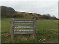
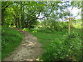
Bridleways in the South Downs National Park, near Liss
by Malc McDonald
geograph for square SU8129
A junction of public bridleways in the South Downs National Park. The Sussex... (more)
|
|
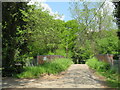
Langley Farm Road, near Liss
by Malc McDonald
geograph for square SU8028
Langley Farm Road is a minor lane through countryside in the South Downs... (more)
|
|
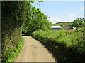
Road to Cornish Farm
by PAUL FARMER
geograph for square TV5695
|
|
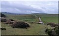
South Downs, looking west from Horseshoe Plantation
by PAUL FARMER
geograph for square TV5695
|
|
Horseshoe Plantation, Beachy Head Road
by PAUL FARMER
geograph for square TV5695
|
|
Sussex Border Path near Liss
by Malc McDonald
geograph for square SU8129
A junction with other bridleways on the Sussex Border Path in the South Downs... (more)
|

|
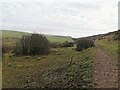
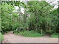
Public bridleway near Liss
by Malc McDonald
geograph for square SU8029
A public bridleway in the South Downs National Park. Here, the bridleway... (more)
|
|
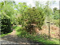
Private driveway near Liss
by Malc McDonald
geograph for square SU8029
A private driveway leading to a house in the South Downs National Park. A... (more)
|

|
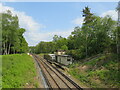
Railway line near Liss
by Malc McDonald
geograph for square SU8029
A Class 450 electric multiple unit train crossing the county boundary from... (more)
|
|
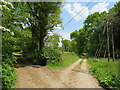
Brewells Lane, near Liss
by Malc McDonald
geograph for square SU8028
Brewells Lane is a minor lane through countryside in the South Downs National... (more)
|
|
Rake Road, Liss, near Petersfield
by Malc McDonald
geograph for square SU7828
Rake Road is a minor lane through countryside in the South Downs National Park.
|
|
Wyld Green Lane, Liss, near Petersfield
by Malc McDonald
geograph for square SU7827
Wyld Green Lane is a minor lane in the South Downs National Park near the village of Liss.
|

|
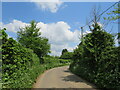
Duckmead Lane, Liss, near Petersfield
by Malc McDonald
geograph for square SU7828
Duckmead Lane is a narrow lane in the South Downs National Park. The blue signs... (more)
|

|
Railway line near Liphook
by Malc McDonald
geograph for square SU8329
A view of the Portsmouth Direct Line in the South Downs National Park, near... (more)
|
|
Railway line and substation near Liphook
by Malc McDonald
geograph for square SU8329
A view of the Portsmouth Direct Line as it passes through the South Downs... (more)
|

|
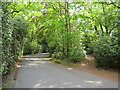
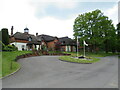
Forest Mere hotel driveway, near Liphook
by Malc McDonald
geograph for square SU8229
A driveway leading to the Forest Mere luxury hotel and spa in the South Downs... (more)
|
|
Driveway and public bridleway near Liphook
by Malc McDonald
geograph for square SU8229
A driveway in the grounds of a hotel in the South Downs National Park. Leading... (more)
|
|
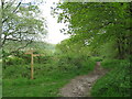
Public bridleway near Liphook
by Malc McDonald
geograph for square SU8130
A public bridleway in the South Downs National Park.
|

|
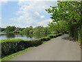
Forest Mere, near Liphook
by Malc McDonald
geograph for square SU8130
Forest Mere is a luxury hotel and spa in the South Downs National Park.
|
|
Hotel driveway near Liphook
by Malc McDonald
geograph for square SU8130
A driveway in the grounds of the Forest Mere luxury hotel and spa in the South... (more)
|
|
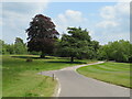
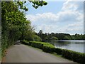
Forest Mere, near Liphook
by Malc McDonald
geograph for square SU8130
A turning circle outside Forest Mere, a luxury hotel and spa in the South Downs... (more)
|
|
Driveway and path near Liphook
by Malc McDonald
geograph for square SU8129
A driveway providing access to a house in the South Downs National Park. The... (more)
|
|
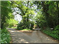
Minor road junction near Liss
by Malc McDonald
geograph for square SU7928
A junction of minor country lanes in the South Downs National Park.
|
|
Hotel driveway near Liphook
by Malc McDonald
geograph for square SU8230
A driveway in the grounds of the Forest Mere luxury hotel and spa in the South... (more)
|
|
Hotel driveway near Liphook
by Malc McDonald
geograph for square SU8230
A driveway in the grounds of the Forest Mere luxury hotel and spa, in the South... (more)
|
|
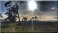
Lord's Piece, West Sussex
by Ian Hawfinch
geograph for square SU9917
This part of the South Downs National Park has a relatively 'wild' and... (more)
|
|
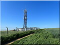
Mast at Saltdean
by Marathon
geograph for square TQ3802
This mast at the very top of Longridge Avenue in Saltdean is a valuable pointer... (more)
|

|
Friston Forest, Sussex
by Ian Hawfinch
geograph for square TQ5300
|