2019
NZ3749 : County boundary on Salter's Lane, near Seaham
taken 6 years ago, near to Seaton, County Durham, England
County boundary on Salter's Lane, near Seaham
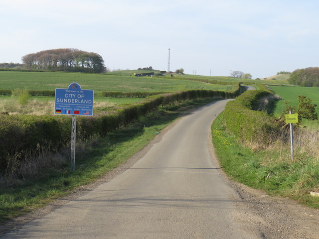
The blue sign marks the point where Salter's Lane crosses from County Durham into the county of Tyne & Wear.
Salter's Lane is on the route of the Walney-to-Wear (W2W) long-distance cycle route.
Salter's Lane is on the route of the Walney-to-Wear (W2W) long-distance cycle route.
Walney to Wear / Walney to Whitby (W2W) cycle route
The Walney to Wear (W2W) cycle route is a long-distance route across the north of England. It stretches for 151 miles from Walney Island, on the west coast close to the town of Barrow-in-Furness, and ends in Sunderland on the east coast. Sunderland is at the mouth of the River Wear. There is also a branch to Whitby, which makes a longer route than the route to Sunderland. The W2W crosses the Pennines, passing England's highest pub (Tan Hill Inn) which is 1,732 feet above sea level.
More information about the W2W can be found on the Sustrans website Link
 Map © Crown Copyright")
TIP: Click the map for more Large scale mapping
- Grid Square
- NZ3749, 13 images (more nearby 🔍)
- Photographer
- Malc McDonald (more nearby)
- Date Taken
- Sunday, 21 April, 2019 (more nearby)
- Submitted
- Saturday, 27 April, 2019
- Subject Location
-
OSGB36:
 NZ 3746 4965 [10m precision]
WGS84: 54:50.4164N 1:25.0953W - Camera Location
-
OSGB36: NZ 3746 4964
- View Direction
- North-northwest (about 337 degrees)