2018
SU1833 : The Monarch's Way, west of Figsbury Ring
taken 7 years ago, near to Winterbourne Dauntsey, Wiltshire, England
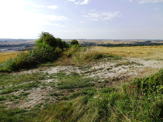
The Monarch's Way, west of Figsbury Ring
This view to the north-west shows the LDP as it leads towards Winterbourne Dauntsey. The Monarch's Way is one of the longer long distance footpaths extending for over 990 kilometres (615 miles) from Worcester to Shoreham by Sea. It mostly follows the route taken by King Charles II to escape from England after losing the Battle of Worcester in 1651 during the English Civil War.
Monarch's Way
The Monarch's Way is based on the route taken by King Charles II during his escape after defeat by Cromwell in the final battle of the Civil Wars at Worcester in 1651, when for six weeks the 21-year-old was hotly pursued by Parliamentary troops. It takes in Boscobel (the Royal Oak Tree), Stratford upon Avon, the Cotswolds, Mendips and the South Coast from Charmouth to Shoreham. The total route is 615 miles. The route is signposted by a crown in a tree (Royal Oak) and ship.
Website: Link
Wikipedia: Link
 Map © Crown Copyright")
TIP: Click the map for more Large scale mapping
- Grid Square
- SU1833, 43 images (more nearby 🔍)
- Photographer
- Brian Robert Marshall (more nearby)
- Date Taken
- Monday, 6 August, 2018 (more nearby)
- Submitted
- Tuesday, 7 August, 2018
- Subject Location
-
OSGB36:
 SU 185 338 [100m precision]
WGS84: 51:6.2085N 1:44.1947W - Camera Location
-
OSGB36: SU 186 337
- View Direction
- Northwest (about 315 degrees)