2011
SN7067 : Dismantled railway and bridge near Ystradmeurig, Ceredigion
taken 14 years ago, near to Ystradmeurig, Ceredigion/Sir Ceredigion, Wales
This is 1 of 2 images, with title Dismantled railway and bridge near Ystradmeurig, Ceredigion in this square
Dismantled railway and bridge near Ystradmeurig, Ceredigion
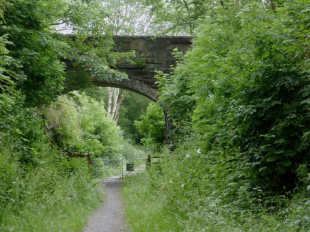
Looking towards Pontrhydfendigaid, this is the course of a dismantled railway line. Beyond the bridge, it swings to the right towards Tregaron, following a straight course across the northern part of Cors Caron. The bridge only carries a farm road to Maesbanadlog.
The Manchester and Milford Railway (which went to neither place) closed in 1965, but the track bed adjacent to and across part of the Cors Caron nature reserve is now used as a public footpath and the National Cycle Route No 82 (Fishguard to Machynlleth via Lampeter and Aberystwyth).
Wikipedia states that this was the Carmarthen to Aberystwyth Line, a standard gauge branch line of the Great Western Railway in Wales. As a result of floods and the Beeching Axe, the line closed throughout to passengers from 1965, and to freight from Pont Llanio creamery near Tregaron to Aberaeron Junction near Lampeter in 1970.
 Map © Crown Copyright")
TIP: Click the map for more Large scale mapping
- Grid Square
- SN7067, 62 images (more nearby 🔍)
- Photographer
- Roger D Kidd (more nearby)
- Date Taken
- Sunday, 10 July, 2011 (more nearby)
- Submitted
- Saturday, 26 November, 2011
- Subject Location
-
OSGB36:
 SN 709 672 [100m precision]
WGS84: 52:17.3004N 3:53.5678W - Camera Location
-
OSGB36: SN 709 673
- View Direction
- Southeast (about 135 degrees)