Grid reference SE9260
near to Wetwang, East Riding of Yorkshire, England
Coverage
We have
22 images
in grid square SE9260
Contribute
Explore gridsquare SE9260
Surrounding area
Maps
 Map © Crown Copyright")
TIP: Click the map for more Large scale mapping
Tip: Click the map to open the coverage map
Sample images
Breakdown list
images taken from SE9260 [1]
A sample of 12 photos from 22
for SE9260
- View this square in the Browser >>>
|
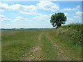
Green Lane, North of Wetwang
by JThomas
|

|
Multiple ruts on York Road Green Lane
A civil parish boundary runs down the middle of the lane - Sledmere to the right/north, Wetwang to the left/south.
|

|
View towards Wetwang
Wetwang stands on a low ridge with higher land to the north and south.
|

|
Green Lane
by Marathon
Green Lane is an ancient trackway. Just ahead it crosses the road from Wetwang to Sledmere and then continues as a green lane on the other side.
|

|
Green Lane
by Ian Lavender
Looking north east towards Sir Tatton Sykes Monument
|

|
Green Lane towards Sir Tatton Sykes Monument
by Martin Dawes
From the Wetwang to Sledmere road
|
|
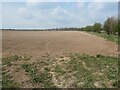
Chalky field, south-west of Sledmere Field Farm
On the north side of York Road Green Lane.
|

|
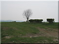
Farmland, Sledmere Field Farm
by JThomas
|

|
The road to Sledmere
by Marathon
This is on the way from Wetwang, just after Green Lane is crossed.
|
|
Green Lane to B1248
by Martin Dawes
It services all the fields on the way but ends up on the B1248, Wetwang to Malton road.
|

|
Green Lane
Green Lane is an ancient route linking York with the east coast near Bridlington.
|

|
Farmland south of Sledmere Field Farm
Rising gently from about 85 metres above sea level.
|
Explore more images in this square: | View Filtering options | View all 22 images page by page >>> |
|