Papers by Frederico Henriques

No texto são apresentados alguns métodos de análise espacial, executáveis em ambiente de Sistemas... more No texto são apresentados alguns métodos de análise espacial, executáveis em ambiente de Sistemas de Informação Geográfica (SIG), com o objectivo de quantificar a área de lacunas brancas de uma pintura sobre madeira do século XVI. Partindo de uma imagem obtida durante uma intervenção de conservação e restauro, da aplicação da análise de componentes principais (ACP) e da utilização de diversos classificadores de pixéis, efectuaram-se mapas temáticos das regiões de lacunas. Foram utilizados quatro métodos: uma divisão automática do histograma em intervalos (level slicing); uma limiarização (thresholding); um método de classificação supervisionada, baseada em áreas de treino, numa assinatura espectral e na aplicação de uma classificação de máxima verosimilhança(CMV); e um de classificação não supervisionada com um algoritmo de agrupamento de células, designado no programa informático de iso cluster. Nas condições em que foram feitos os ensaios, obtiveram-se melhores resultados na identificação das lacunas com a limiarização e a classificação supervisionada.

Ge-conservación, 2020
This paper describes the application of 3D digital technology to support the rebuild of lost deco... more This paper describes the application of 3D digital technology to support the rebuild of lost decorative elements of an historical frame. The frame belongs to an 18th century painting depicting the portrait of D. José, Prince of Brazil, displayed at the National Palace of Queluz, Portugal. The application of digital technologies has been planned from the very beginning in order to avoid the traditional use of silicone in the reproduction of missing elements. The photogrammetric 3D acquisition, a non-contact methodology, has been used to reduce the manipulation and hence prevent further degradation of the artistic object. Following the 3D modelling operation, new decorative elements were made using an additive printing technology. In the final phase of the work, the post-printing treatment was carried out, in which aqueous products were used. 3D modelling, in addition to facilitate the restoration treatment of the historic frame, can also be useful in the creation of a digital collection of decorative frame elements, i.e. a virtual database.
... en Tomar, en el año 1533 (1). No se sabe qué procedimientos y materiales se utilizaron. ... U... more ... en Tomar, en el año 1533 (1). No se sabe qué procedimientos y materiales se utilizaron. ... Una de las primeras descripciones técnicas que conocemos sobre la limpieza de pinturas está en ... valor estético y comercial, sino también por su importancia histórica y cultural para el país ...

IOP Conference Series: Materials Science and Engineering, Jun 1, 2018
The objective of this paper is the presentation of the research strategies adopted and results of... more The objective of this paper is the presentation of the research strategies adopted and results of the ongoing BIONANOSCULP research project that is aiming to develop solutions in the area of sustainable nanomaterials, which are non-invasive and high-performance in their preventive conservation approach. An integrated methodology was designed as a holistic strategy to the characterisation of the microbiota present on the surface of public outdoor sculptures. Gathering objective data in the characterization of the surface microbiota of public outdoor sculptures is important, in order to design strategies for the preventive conservation of these objects that make use of biotechnology innovative coatings. Such is one of the objectives of the project BIONANOSCULP. Methodologies applied include conservation reports, surface sampling methodologies using gels, 3D modeling, SEM, flow cytometry and metagenomics. The project is already significantly contributing to create a bridge between the experts from different areas: the skills of biotechnologists, microbiologists, materials scientists, art historians and conservators-restorers to assess the state of conservation, biodeterioration and biocontamination of a selected number of sculptures, and to design the appropriate materials to pursue preventive conservation through coatings with anti-microbial activities.
Conservar Património, 2010
Resumo Este estudo trata da aplicação de técnicas simples de processamento de imagens, em ambient... more Resumo Este estudo trata da aplicação de técnicas simples de processamento de imagens, em ambiente de sistemas de informação geográfica (SIG), tendo por base uma fotografia digital de pormenor de uma pintura retabular. O objectivo consiste em documentar, de modo semi-automático, a densidade de lacunas, através de reclassificação e da estimação de densidade de pontos. A imagem fotográfica que se usa no exercício diz respeito ao painel da "Ressurreição de Lázaro", obra do século XVI, pertencente à Charola do Convento de Cristo, em Tomar. O resultado final é um mapa temático das patologias do tipo de lacunas.
The objective of this paper is to present a workflow procedure to support the graphic recording o... more The objective of this paper is to present a workflow procedure to support the graphic recording of the operations performed during the retouching process involved in paintings. In this particular context, an orthophotography of a portrait painted on canvas from a university museum collection was used in Blender, a free and open-source 3D creation software suite. Blender uses an important metric coordination value, provided by the 3D workspace software that allows the areal characterization and numeric identification of each surface loss. The step-by-step procedure adopted to document and map lacunae in this artwork for subsequent retouching, is described.info:eu-repo/semantics/submittedVersio
Ge-conservacion, 2020
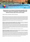
A reintegração cromática de uma pintura é sempre um desafio para os conservadores-restauradores e... more A reintegração cromática de uma pintura é sempre um desafio para os conservadores-restauradores e a decisão de como reintegrar é geralmente baseada no valor e na função das obras. Porém, a escolha de qual a técnica de reintegração é a mais adequada nem sempre é fácil de se justificar. Para tentar ajudar a dar resposta a esta questão foi utilizado um software de Sistema de Informação Geográfica (SIG), designado de QGIS®. Através da edição vetorial foram efetuados vários mapas temáticos com a finalidade de registar as lacunas que se observavam nas pinturas. A análise efetuada com o auxílio do SIG permitiu fazer a caracterização espacial das lacunas em área, para facilitar a tomada de decisão da técnica de reintegração a ser aplicada. Como caso de estudo utilizou-se uma pintura académica de Adriano de Sousa Lopes (1879-1944). Na reintegração cromática usaram-se três técnicas conhecidas de conservação e restauro: o processo mimético, a selezione cromatica e o pontilhismo.
In the documentation in conservation context, there is an increasing demand for precise and accur... more In the documentation in conservation context, there is an increasing demand for precise and accurate data and also for full three dimensional records of the cultural heritage. This paper presents the study case of a painting by Amadeo de Souza-Cardoso before, during and after the retouching treatment. The work focuses on the use of open source systems, such as GIS and photogrammetry software, in order to produce accurate maps of object losses and realistic virtual 3D models enabling the study of artworks with a minimum budget and a low cost infrastructure.
In the framework of Geospatial Technologies (GT) the study of the terrestrial surface through var... more In the framework of Geospatial Technologies (GT) the study of the terrestrial surface through various processes of acquisition, processing and analysis of spatial information, related to the most varied phenomena, is often done. However, the abstraction of models and methods used for this purpose allows their application in the spatial analysis of any other surfaces, such as the digital images of paintings. This extension of the traditional field of GT allows quantifying multiple spatial characteristics of the surfaces interesting in the documentation for Heritage Studies. Despite the clearly different scales between the objects of the study of the two domains of knowledge, the representation and analysis of paintings can be performed with methodologies generally used to characterise the terrestrial surface, being useful in the documentation process for Conservation, especially in the visualisation and in the pictorial spatial quantification. The thesis presents some perspectives on the application of Geographic Information Systems (GIS) in the spatial analysis of paintings, aiming to document surface phenomena, as well as the results of processes of classification and image analysis with landscape metrics.


Uploads
Papers by Frederico Henriques